Big Walk Island Map: Landmarks, Towers, and Cable Cars
How navigation works in Big Walk — the paper map, Map Room, towers as progress markers, cable car transit, and coordinates explained.
No Minimap, No Compass — What You Actually Get
Big Walk has no on-screen navigation UI at all. Instead, the game gives your group three layers of wayfinding: a physical paper map someone has to carry, a Map Room on the island with a large terrain model, and landmarks with distinct silhouettes you learn to name. Every successful navigation call in this game is a sentence like “meet at the east cable car” — which is exactly why voice chat matters (see how voice chat works).
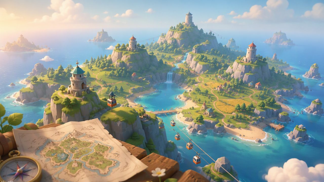
Towers: The Island’s Spine
Towers are the most important structures on the map. The host chooses at world creation whether the island spawns with 2, 3, or 4+ towers, and that choice shapes the whole run:
- Each tower is a region’s landmark and puzzle hub.
- The main ending path requires activating the towers, then traveling to the Black Obelisk.
- More towers = longer session, more puzzle variety.
Cable Cars and Region Travel
Cable cars are the island’s long-distance transit. Learning the cable car network is the single best navigation investment a group can make — shouting “take the east cable car” beats five minutes of “walk past the big rock, no the other rock.” The true-ending purple-door area is even hidden behind the eastern cable car point, which rewards players who actually learn the network.
The Map Room and Paper Map
The Map Room contains a large physical model of the island — your only “zoomed out” view of the world. The portable paper map is the field version: someone carries it, someone else calls out features, and together you triangulate. Groups that designate a navigator and a map-reader finish puzzles measurably faster; wandering pairs that both guess get lost.
Landmarks and Giving Coordinates
Veteran groups quickly develop their own landmark names — “the antenna hill,” “the twin pines.” Combined with rough compass directions, this becomes the island’s informal coordinate system. A few habits worth copying:
- Name every distinctive thing you find, out loud, once. Shared vocabulary saves hours.
- When separated, report a landmark plus a direction (“I’m at the bridge, south side”).
- If truly lost, ask someone with the paper map to guide you in over the radio — that’s what it’s for, and the tools list explains which items extend your sight range.
Map FAQ
Does the map change between sessions? The host’s world layout (number of towers) persists in their save. Item and puzzle placement follows the chosen layout.
Is there a fast travel system? Cable cars are the fast travel. Everything else is walking — deliberately.
Where do I find the paper map? Early on, near spawn areas — but its exact spot is something we leave for your group to discover on the ground. This page intentionally stays spoiler-free on locations.
Related Articles
Was this helpful?
Thanks for the feedback!